|
More on the statellites
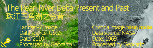
Corona, USA's first operational intelligence satellite, carried sophisticated optical cameras (KH-4B system) to acquire imagery of the Earth from space at an altitude of 80 nautical miles (150 km). It was launched in 1967. The camera system included two 24-inch focal length, f3.5 panoramic cameras with separate forward looking and rear looking capability, and a tilting angle of 30 degrees to take stereoscopic photos. Films taken by the camera were contained in a capsule. The satellite was designed to de-orbit the film capsules from space, which were recovered in mid-air by specially equipped aircraft.
The mission life of the system was 19 days. The frame format of the panoramic camera was about 2.18 x 29.8 inches. Each frame covered a ground area of about 8.6 x 117 miles (14 x 188 km). The best quality resolution of 6 feet (2-metre) can be enlarged nearly 40 times up to 1:7,500 from the original film at a nominal scale of 1:247,500.
Declassified in 1994, the photos taken by the satellite constitute a valuable source of historical information for study of environmental changes.
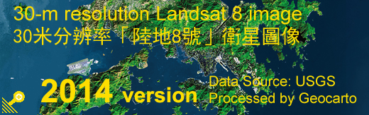
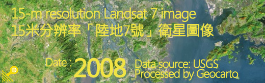
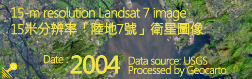
Landsat was called ERTS (Earth Resources Technology Satellites) when it was first launched in 1972. This series of satellites was renamed Landsat in 1995. Administered by USGS/NASA, Lansat-5 acquired only colour images of 30-metre resolution. Landsat-7, which launched on April 15, 1999, is orbiting the Earth at an altitude of 705 km. It acquires black and white images with a resolution of 15-metre and colour images with a resolution of 30-metre.
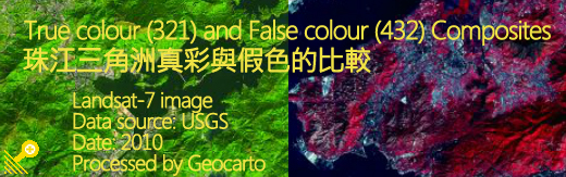
Unlike the Corona satellite which captured imagery on photographic films, Landsat satellites carry sensors to collect electromagnetic radiation reflected from the ground. The data ware converted into electrical signals and then transmitted in digital form to a ground receiving station. These digital data are subsequently processed to generate images. The imagery is composed of a matrix of pixels. Each pixel represents the amount of light within a spectral band reflected from the Earth's surface. Using various combinations of spectral bands, different techniques of image processing and enhancement as well as merging of different remotely sensed data, spectacular images can be generated to highlight particular features to facilitate interpretation and analysis.
|